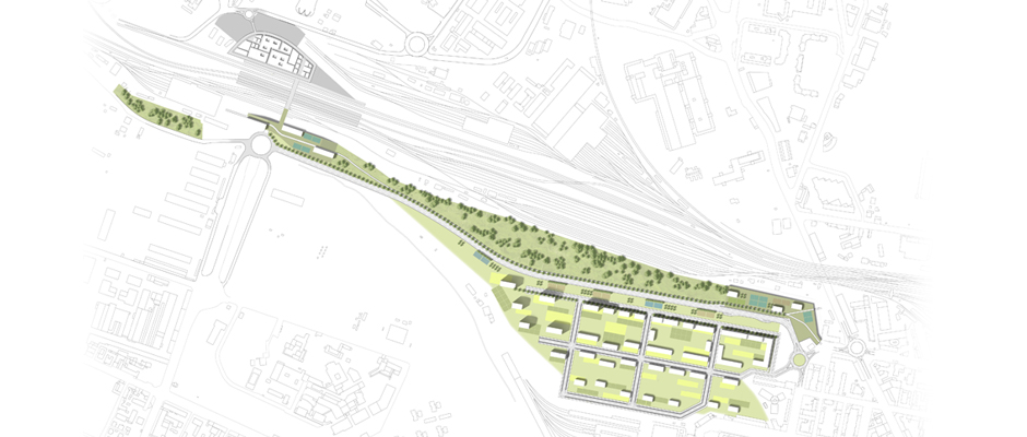
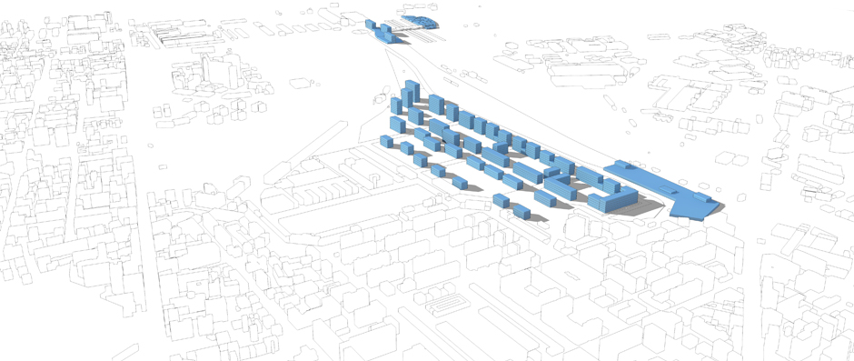
The urban transformation program of the Ravone area takes part of a highly complex territorial context, which will be facing in the near future a major transformation process. The site lies between the Ravone creek and the railway tracks and its shape immediately reminds a “comma” developing in the east-west direction, completely autonomous from the nearby XIX century existing urban tissue. The proposed strategy identifies the Ravone creek as the infrastructural backbone of a new environmental system flowing into the popular Reno river territorial park. In addition, a new urban tissue establishes a clear continuity with the adjacent street network, according to a four strip arrangement, each of them performing a different relation between green and solid spaces. The environmental system and the morphological one become complementary to each other because of an “open hand” shape. A new road, named “Sussidiaria”, running parallel to the via Emilia Ponente, embodies the fast connection between the area outside the city boundaries and the new Tanari parking lot, which represents the architectural entrance to the project area from the city centre.
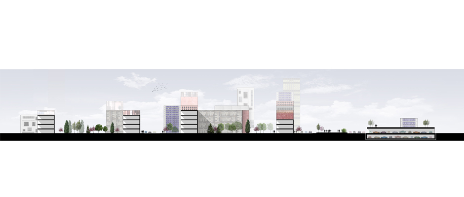
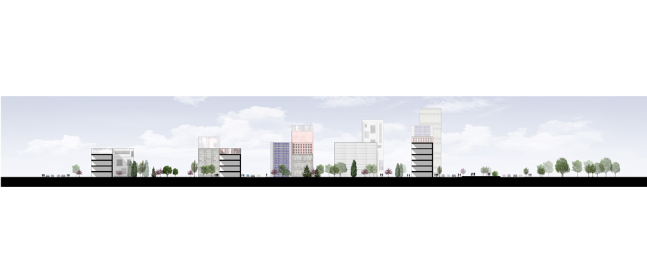
As already mentioned, the proposed morphological framework reinterprets the existing XIX century urban block arrangement, becoming even more permeable from north to south. It emphasizes the will to maximize the environmental and energetic sustainability of the entire project, intermingling both private and public control. According to these premises, the northward strip hosts high density building curtain which fence neighborhood courtyards accessible to the public, also characterized by functional mix. Moving southward, the urban block morphology progressively opens up: density and building height decrease, the overall atmosphere becoming even more residential, ending into an urban villa arrangement.
Moving westward, in the direction of the Reno river park, tower buildings free space at the ground level to increase the environmental system pedestrian and cyclist accessibility. The peak of density corresponds to the Prati di Caprara Metro system stop, which also acts as a strategic threshold between the area and the new urban quarter, currently under development up north, named Bertalia Lazzaretto district. Here prevails a request of urban congestion, leading to a very dense mat building hosting urban functions on both side of the infrastructure. Southwars, the mat building roofscape intersects the park, bridging flows to cross over the railway tracks.